AT A GLIMPSE
– Circular trip, 2 separate wadis and 1 open plateau
– Distance: 7km
– Activities: boulder hopping in the wadis, no steep descents or ascents, one bit of scrambling, short up- and downhill on loose rocks
Background
The hike is situated in the southern part of Ras Al Khaimah. The Wadi Safarfir area is particularly known for its extensive copper winning activities during the Bronze Age (2nd millennium BC) and again during the early islamic period (9th – 11th centuries).
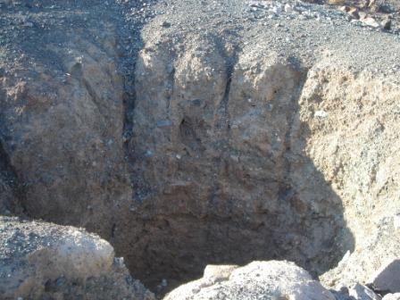
You will walk through two wadis: one is Wadi Safarfir (also known as the Valley of the Coppersmiths), where a mineshaft can be found as well as lots of greenish copper ore and remnants of the mining village.
The other one is Wadi Ghargur, similarly known for copper winning activities. Here you can see an open field with a lot of copper slag and also remnants of houses and terraced fields.
Direction & Coordinates
| Waypoint | Direction | North | East | Elevation | |
|---|---|---|---|---|---|
| 1 | On Sharjah Kalba road Exit Munay | Take Right | N24 57.582 | E056 08.757 | 267 m |
| 2 | Roundabout Huwaylat | Take Right | N24 53.125 | E056 10.193 | 219 m |
| 3 | Entrance to Wadi Safarfir | Take Right | N24 52.766 | E056 08.879 | 261 m |
| 4 | Start Hike & Copper Mine Shaft | Take Left | N24 52.969 | E056 08.060 | 266 m |
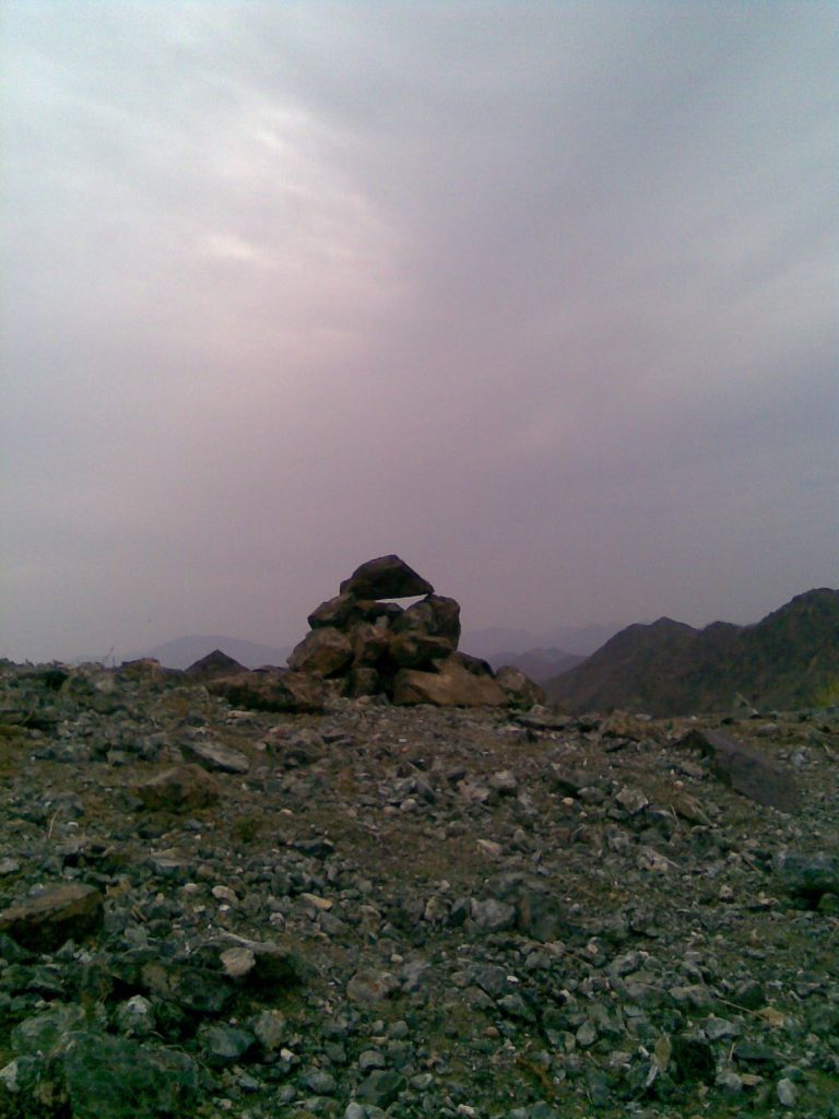
| 5 | Pass (= Copper Summit) | Go down, take left | N24 52.532 | E056 07.314 | 391 m |
| 6 | On the Plateau | Take Left | N24 52.405 | E056 07.372 | 323 m |
| 7 | Start Wadi Ghargur | Take Left | N24 52.335 | E056 07.814 | 342 m |
| 8 | Slag Fields/End Hike | End | N24 52.850 | E056 08.355 | 262 m |
Pin 1: On Sharjah Kalba road Exit Munay
Pin 2: Roundabout Huwaylat
Pin 3: Entrance to Wadi Safarfir
pin 4: Start Hike & Copper Mine Shaft
Pin 5: Pass (= Copper Summit)
Pin 6: On the Plateau
Pin 7: Start Wadi Ghargur
Pin 8: Slag Fields/End Hike
Description of the Hike
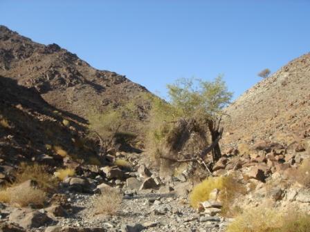
The hike starts in Wadi Safarfir.
But before you take off, it is worth to wander around and explore this spot. By climbing ancient stone steps which will lead you up to the top of a small hill, you will be able to see a very old copper mine shaft.
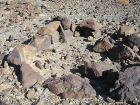
Everywhere around you, you can see remnants of houses, mining buildings, furnaces, terraced fields. The ancient stones of the walls are still lined up, but not for more than just a few layers.
When you move up into the wadi, the sharp eyed will notice remnants of a falaj on the right hand side: stones, held in place by mud. This sort of water canals required regular maintenance by the community in the bygone times. Unfortunately this image of the past is now quickly degrading and disappearing; these beautiful irrigation canals are being replaced by black plastic tubes (cheaper and readily available in the corner shop.
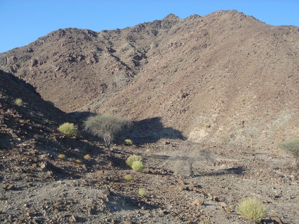
After about half an hour, the wadi splits in two equal, smaller river beds: take right here and climb your way up to the pass. This part is a bit more difficult because of the loose gravel. The views become more and more spectacular. Your short climb (about 45 minutes) will be rewarded with great 360 degrees views.
On the other side of this pass, you can see the lower wadi bed, and some trails and electrical pylons in the distance.
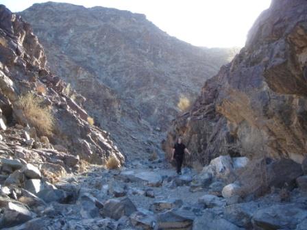
So here you will start the descent; it`s not a long one but again, the loose rocky bits need your careful attention.
You will arrive in an unshaded plateau that becomes wider and wider. Tracks and trails lead to almost any point of the compass, so don`t get confused. Follow the coordinates accurately.
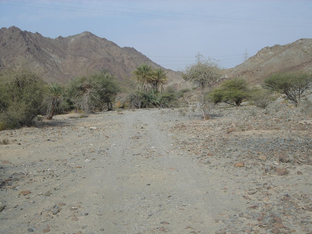
After about 30 minutes, you will enter the pleasant Wadi Ghargur. This wadi offers a variety of views, plants, trees and birds.
You will notice that you are not the only one who likes this riverbed: dung of goats and donkeys everywhere.
This is a relatively short wadi but you will enjoy it because of its sheer beauty. Thankfully it is still very unspoiled and pure, probably because it is not an obvious or accessible pick nick spot.
Again, here are traces of human settlements (walls of dwellings and falaj) albeit very degraded.
It`s mostly great boulder hopping, not difficult or extreme and very amusing.
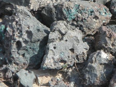
At the end of the hike, there is an open field with loads of copper slag (= residue after the mineral was run off in the smelting procedure): some particles are shiny black and have an even surface. Others look like funny shaped bits of rock full of holes and with a coarse surface. If you look carefully you will be able to find copper slag which still has the shape of the round crucible.
![]()