Introduction.
Mount meliha is the most nearest hiking spot to Dubai residents. Just an hour away from downtown Dubai. Its a small mountain with nothing much to view but good a and evening hike. It is very much know as fossil rock.
There are two hiking trails there. one is a small one which may take an hour to go the the final point and then return back. Its a good evening exercise for legs.
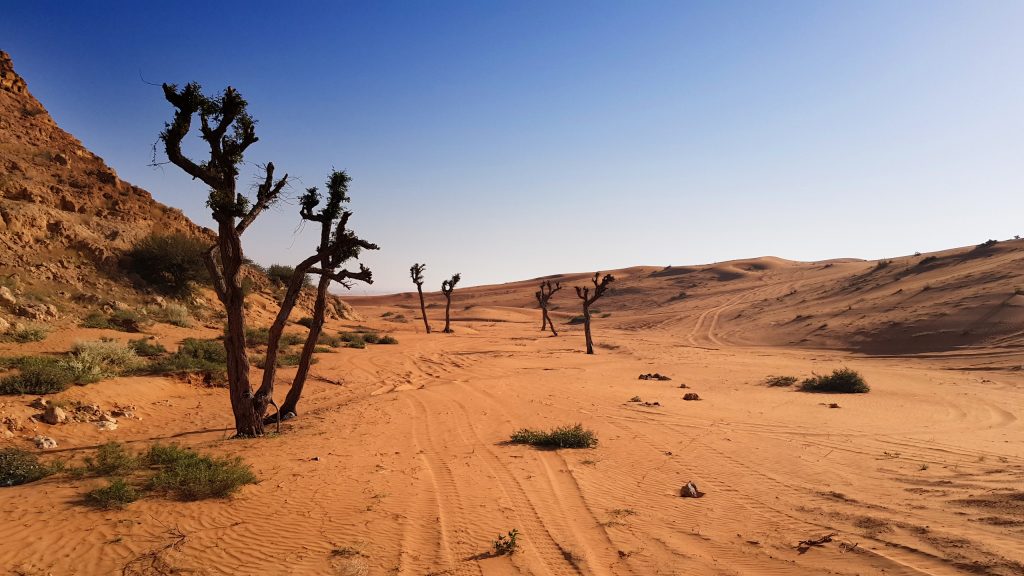
The other one is a 3 hour hike along the entire stretch of the mountains and return is a walk through sand. The second one is not for beginners as its bit tough and will be categorized into the moderate level hike.
Check list
Basic requirement for this is hike is given below:
- Hiking shoe / runners with good grip,
- Water min 2 liters (Very important)
- food, snacks, chocolates
- Soft drinks (Just in case of extreme low energy conditions)
- GPS / Maps / Smart phone with offline maps.
- Battery pack for Electronic devices like GPS and smart phones
- backpack
- pen torch
- Knife
- Medication like panadol / anything you may feel you might need.
We do have an extensive list of things which you can carry for hike here in this link as a separate article.
feel free to go through the list and see what you think you might need.
Direction and Coordinates
Start of small Hiking trail.
Pin 1: The marked pin is a kacha parking space on the side of the sharja – kalba main road. We dont know if its a public parking area or private. But so far we have been parking there and there were no problem with that.
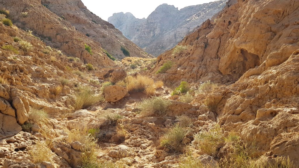
Pin 2: Next pinned point the place where you can start you actual climb. Till there you have to go through plain ground. Once you reach the pin location you are going to start climbing through the valley up the mountain.
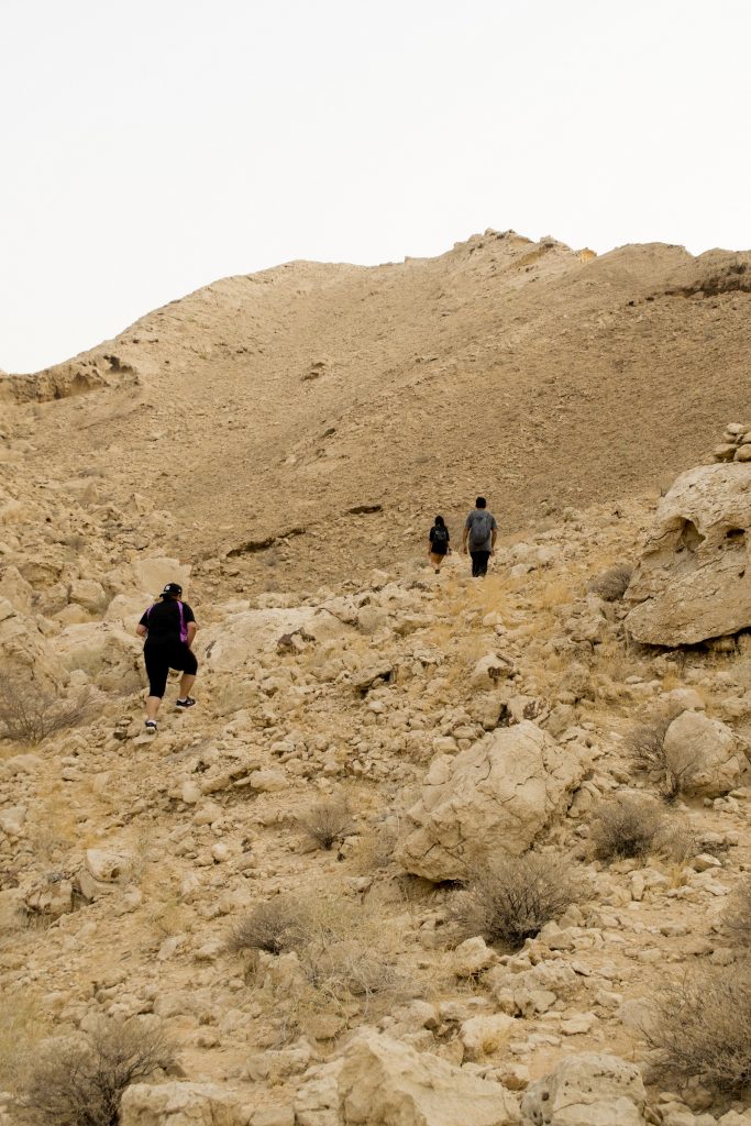
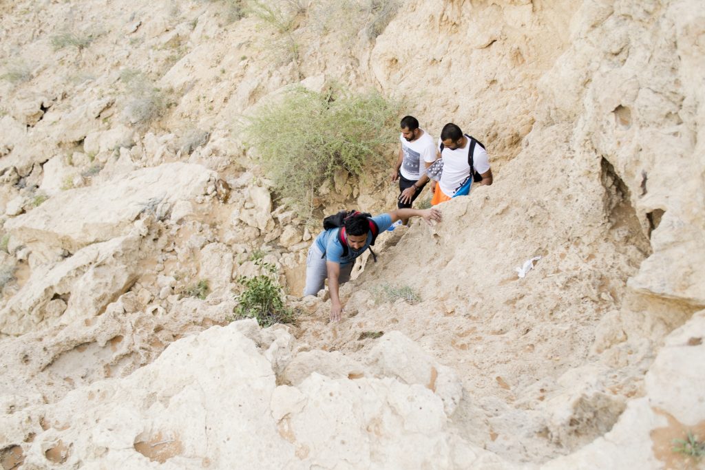
Pin 3: This is bit tricky here. A small climbing is required here and as a beginner you have to be very careful. Its a bit challenging. If you take your time and with efforts from experienced hikers in the group you will be able to climb this 10 feet wall.
Pin 4: At this point, you need to take right to the final spot. If you go straight it will lead to the other lengthy hike which i described earlier. So take right.
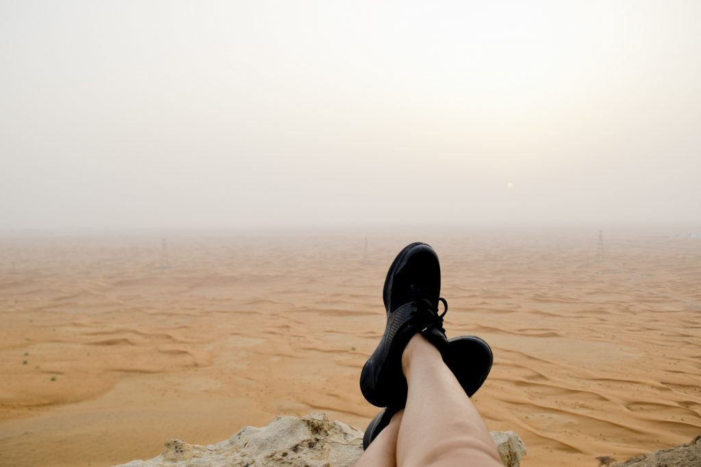
Pin 5: This is the final spot. Enjoy the view.
End of small hiking trail & Start of Big trail.
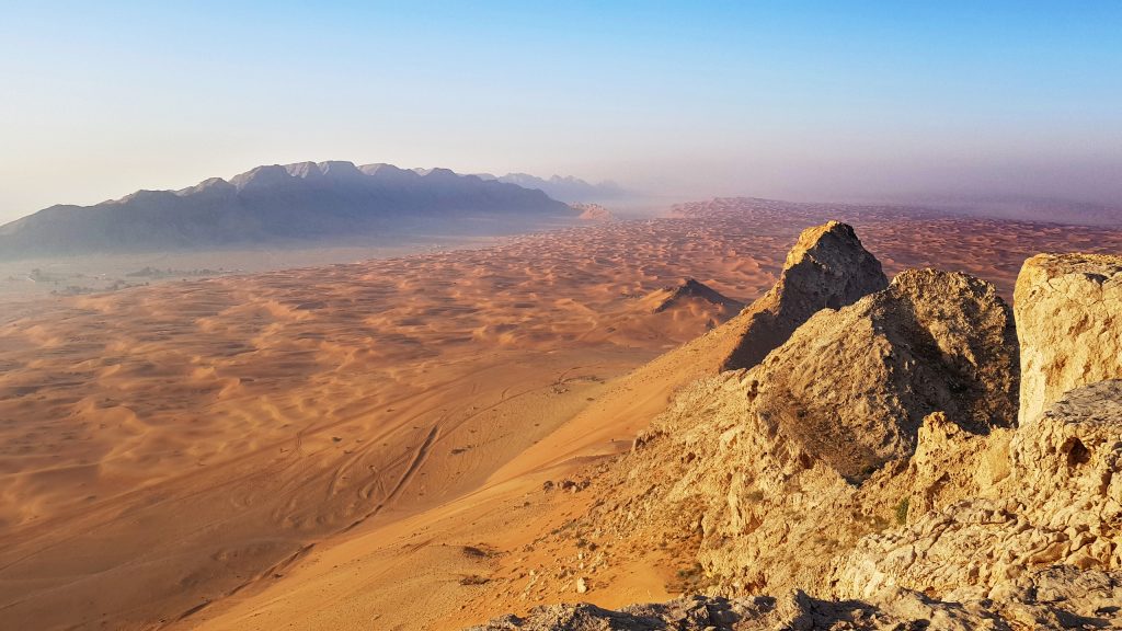
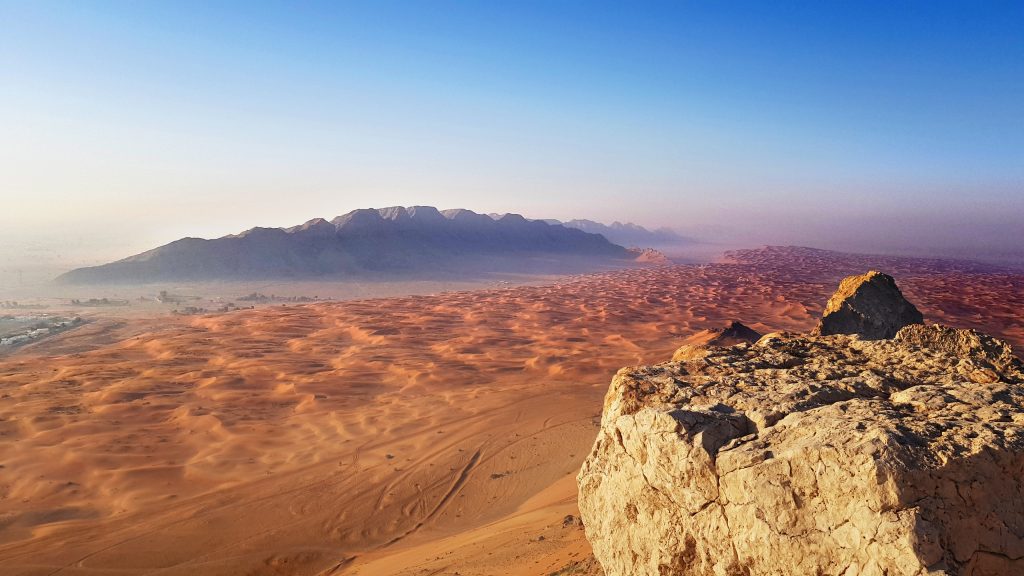
From the location pin no 5, all you have to do is climb up the the top of the mountain on to your south. Its a small 300 feet steep hike. Easy one. Once you reach at the top you will find a plateau like, table top of the mountain. Head south towards the far end of the mountain.
Try to keep away from the edges of the of the cliffs. I may be too dangerous to stay on edges. Loose rocks may end you up down the valley 30 feets down.
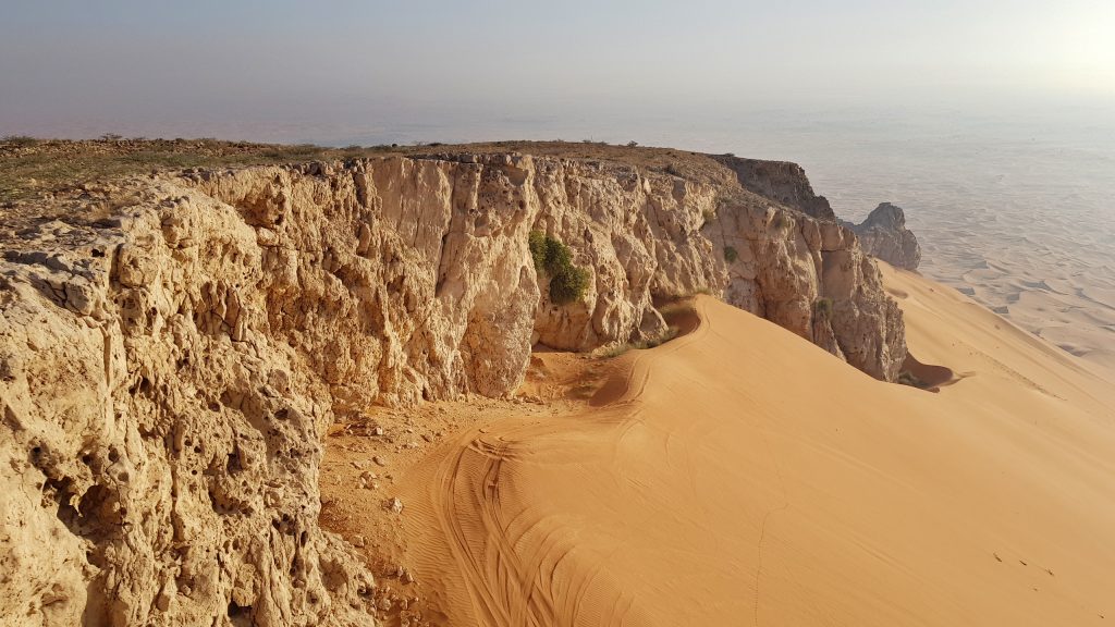
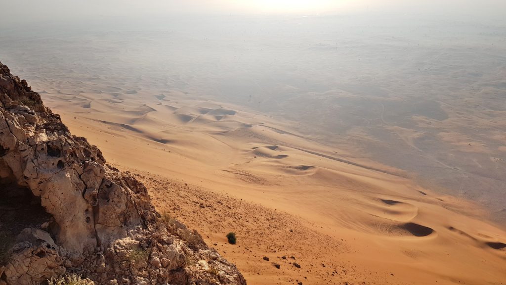
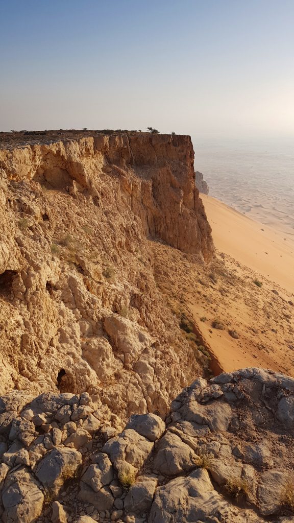
The view from the top is mesmerizing for this small hike. It would be a nice idea you hike up this mountain early morning for the better view.
Returning point.
There are two was you can go back. One way is to climb down front this edge which is kind of slow and require caution. But its possible and then walk trough the side of the mountain through sand to reach the parking area.
The other way to go all the way which you came back. It will be tiring and if you want to enjoy a good work out, that would be the good option. But this is the easiest route.
![]()